Rain After Wildfire Can Bring a Hidden Risk to Rivers
USGS-backed research shows how rain after a wildfire can create dangerous river conditions under certain circumstances, adding another reason water monitoring matters after the flames are out.
Save Article
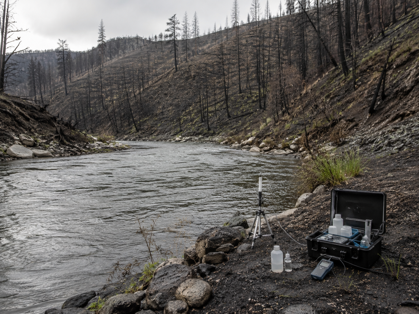
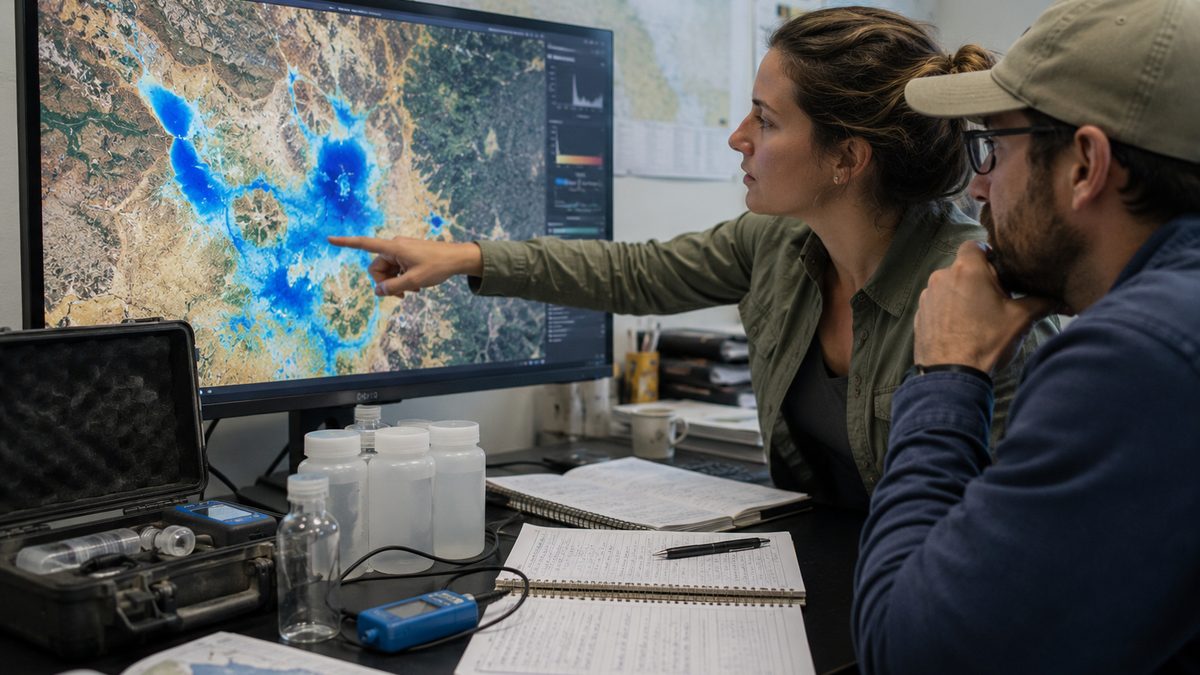
Recent research shows why water quality can become a concern after wildfire and rainfall. Editorial illustration by TheDailyGlobe.
Key Facts
- USGS described research linking a rain-on-wildfire event to lethal water-quality conditions in a large river.
- The research highlights how rainfall after wildfire can, under certain conditions, strip oxygen from rivers and kill fish.
- Continuous water-quality monitoring is important for detecting sudden changes after fires.
- The Water Quality Portal integrates public water-quality data from USGS, EPA and hundreds of partners.
- Risk depends on local conditions, including fire severity, rainfall timing, watershed features and monitoring coverage.
After a wildfire, it is natural to look for the obvious signs of danger: smoke, flames, damaged homes, closed roads and burned hillsides. But in some places, one of the next risks can move quietly downhill with the first hard rain.
USGS-described research has linked a rain-on-wildfire event to lethal water-quality conditions in a large river. The finding points to a post-fire problem that can be easy to miss: runoff from burned land can change river conditions quickly enough to threaten fish and complicate recovery for downstream communities.
The research does not mean every wildfire followed by rain will produce dangerous river conditions. It does show why the end of a fire is not always the end of environmental risk.
How Rain Can Change A River After Fire
Wildfire can leave behind ash, burned vegetation, exposed soil and changed ground conditions. When rain falls on that landscape, water can carry material from hillsides and streambanks into nearby creeks and rivers.
That runoff can affect water quality in several ways. One concern highlighted by the USGS research is oxygen. Fish and other aquatic life need dissolved oxygen in the water. If conditions cause oxygen levels to drop too far, the water can become dangerous or deadly for fish.
The exact process depends on the watershed. Fire severity, how much rain falls, how quickly it falls, what burned, how close the burn area is to the river and how the river was flowing before the storm can all matter.
Why The Risk Is Easy To Overlook
Post-fire recovery often focuses on land: erosion, mudslides, damaged trees, rebuilding and smoke impacts. Those are real concerns. But rivers can also carry the effects of a fire well beyond the visible burn scar.
That matters for communities, tribes, anglers, water managers and environmental agencies. A river affected by post-fire runoff can raise questions about fish habitat, public water systems, recreation and the health of connected ecosystems.
The risk is not the same everywhere. A small fire followed by light rain may not create the same concern as a severe burn followed by a strong storm in a steep watershed. That is why the finding is best understood as a warning about conditions that can happen, not a blanket prediction for every burned area.
Why Monitoring Matters
The USGS research highlights the value of continuous water-quality monitoring. Sudden river changes can happen quickly, and occasional sampling may miss the moment when oxygen levels drop or other water conditions shift.
Continuous monitoring can help scientists and water managers see what happens before, during and after a storm. That kind of data can help show whether a river is recovering, whether fish are at risk and whether agencies need to watch certain watersheds more closely after future fires.
The Water Quality Portal, supported by USGS, EPA and hundreds of partners, is part of the public data infrastructure behind this work. It brings together water-quality information that researchers, agencies and communities can use to better understand changing conditions.
What Is Still Unknown
One open question is how many fire-prone watersheds have enough continuous monitoring to catch these events when they happen. Some rivers may be watched closely. Others may not have the same coverage, especially in remote or under-resourced areas.
It also remains unclear how quickly agencies can use findings like this in planning. Expanding monitoring, choosing where to place sensors and deciding how to share warnings all take money, staff and coordination.
The science also needs to be careful about scale. A documented event can show what is possible and why it matters, but more monitoring may be needed to understand how common these oxygen-stripping events are across different regions and fire conditions.
What Communities May Watch Next
For communities near burned watersheds, the practical question is what happens when the first major storms arrive. That does not mean panic. It means water agencies, environmental managers and local officials may need to treat rain after fire as part of the recovery period.
Future attention may focus on whether continuous monitoring expands in fire-prone areas, how agencies identify high-risk watersheds and how quickly data can be used when storms move over burn scars.
The larger lesson is straightforward: wildfire can keep affecting a landscape after the flames are gone. Sometimes the next warning sign is not smoke in the air, but a river changing after rain.
Reporting note: Reporting draws on USGS research materials, public water-quality data infrastructure, wildfire-water monitoring background, and reviewed environmental science context. This article was produced with AI-assisted research and reviewed by an editor before publication.