Weather Satellites Are Everyday Safety Technology, Not Just Space Hardware
NOAA's GOES satellites help support forecasts, storm monitoring, wildfire tracking, space weather alerts and search-and-rescue work people rely on every day.
Save Article
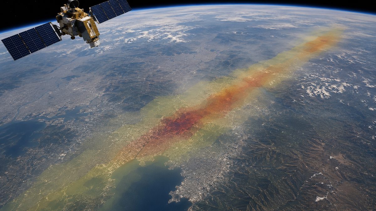
Weather satellites help turn space-based observations into forecasts and warnings people use on the ground. Editorial illustration by TheDailyGlobe.
Key Facts
- NASA says NOAA's GOES satellites have provided continuous imagery and data on atmospheric conditions and solar activity since 1975.
- NASA says GOES data supports more accurate and timely weather forecasts.
- NASA/NOAA materials say GOES-U and GOES-19 instruments collect advanced imagery and atmospheric measurements.
- NASA/NOAA materials say the satellites help map lightning activity and detect space weather hazards.
- NASA says GOES-U was the fourth and final satellite in NOAA's GOES-R Series.
A family checking a severe weather alert before driving, sending kids to school or deciding whether to shelter is using more than a phone app. Behind that alert is a system of satellites, sensors, models, forecasters and emergency communication tools.
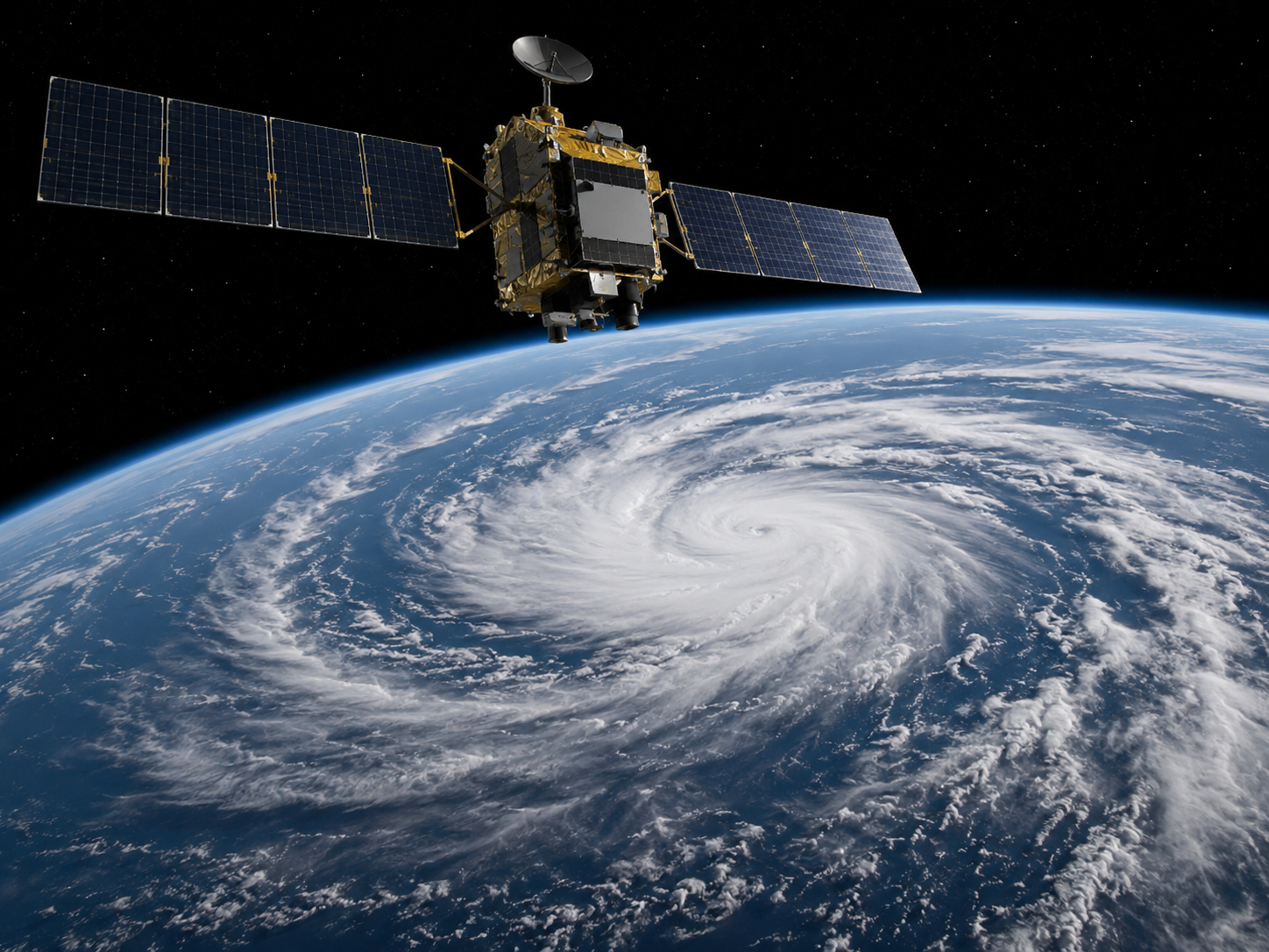
One important part of that system is NOAA's GOES satellite network. NASA says GOES satellites have provided continuous imagery and data on atmospheric conditions and solar activity since 1975, helping meteorologists monitor weather and environmental conditions across much of the Western Hemisphere.
That makes weather satellites everyday safety technology, not just space hardware. They help turn distant observations into forecasts and warnings that can affect travel, school schedules, wildfire response, storm preparation and emergency planning.
How Satellites Help Forecasts
Weather satellites give meteorologists a wider view than ground instruments can provide by themselves. From orbit, GOES satellites can watch storm systems develop, track cloud patterns, collect atmospheric measurements and help show how conditions are changing over time.
NASA says GOES data supports more accurate and timely weather forecasts. That does not mean a satellite creates a forecast on its own. It means satellite data becomes one part of a larger forecasting system that includes weather models, radar, ground observations and human forecasters.
For people on the ground, the value is practical. Better information can help forecasters issue warnings, update storm tracks and explain changing conditions before people make decisions about travel, shelter or outdoor work.
More Than Storm Pictures
The public often sees satellite imagery as dramatic pictures of hurricanes or cloud bands. GOES satellites do more than that. NASA and NOAA materials say GOES-U and GOES-19 instruments collect advanced imagery and atmospheric measurements, map lightning activity and detect space weather hazards.
Lightning mapping can help forecasters understand storm intensity and development. Wildfire monitoring can help agencies watch heat and smoke conditions. Space weather detection matters because solar activity can affect communications, navigation systems and technology infrastructure.
The same satellite network also supports search-and-rescue work. That is another reason the technology belongs in the public-safety category, not just the space category.
What Satellites Cannot Do Alone
Weather prediction is still difficult. Satellites can provide powerful observations, but forecasts also depend on computer models, meteorologists, ground systems, radar, ocean data and changing local conditions.
That is why a satellite update should not be treated as a perfect answer for every neighborhood. Storms can shift. Local flooding can depend on drainage, terrain and rainfall rates. Wildfire conditions can change with wind, humidity and fuel on the ground.
The right way to understand weather satellites is as a major visibility tool. They help forecasters see more, sooner and across larger areas, but they do not replace the rest of the warning system.
What To Watch Next
The next developments to watch are NOAA and NASA satellite updates, new forecasting tools and how agencies use GOES data in warnings for storms, wildfires and space weather.
Readers should also watch how emergency managers and local forecasters explain alerts. The best technology still depends on clear communication, especially when people have only minutes or hours to act.
For now, GOES satellites are a reminder that some of the most useful space technology is not distant from everyday life. It is part of the safety system people rely on when the weather turns.
Reporting note: Reporting draws on NASA mission materials, NOAA/NASA satellite resources, official GOES program materials, and reviewed background materials. This article was produced with AI-assisted research and reviewed by an editor before publication.